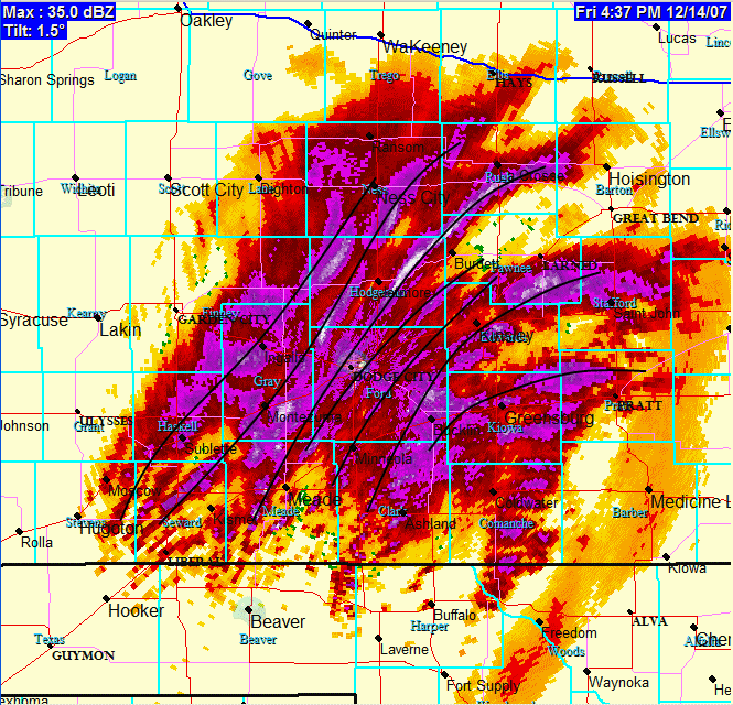
 Around 5" now! Man, I’m loving this! Radar loop still looking good around Dodge City with narrow intense bands of heavy snow. The snow has changed a little bit… much smaller flakes, but very numerous. This is a type of snow that can really accumulate fast. We may be at 7 or 8 inches by mid-evening… which was the upper end of the forecast. Here is a radar image below. I drew some black lines where the intense frontogenetic bands are centered:
disclaimer: "The meteorological
views/forecast
thinking expressed are those solely of the author of this blog
and do not necessarily represent those of official National Weather Service forecast products,
therefore read and enjoy at your own risk and edification!"
and do not necessarily represent those of official National Weather Service forecast products,
therefore read and enjoy at your own risk and edification!"
December 14, 2007
Kansas Snow, Dec 14-15, 2007 [post 5]
No Comments »
No comments yet.
RSS feed for comments on this post. TrackBack URL