June 2nd was the last of my 3-day mini-chase trip. I started the day in Ogallala with Matt Crowther, Greg Brenneman, John Moore, and the "Original" Twister Sisters (Linda Kitchen and Kathy Velasquez). Our target was west on I-80 near Sidney in anticipation of storms forming off the Laramie Range to the west. There was a bunch of low clouds and light fog/drizzle to start the day across much of the Nebraska Panhandle, and this lingered through about midday before finally clearing off. I parted ways with Matt’s group at Kimball, deciding to head west to the Wyoming border to monitor the first significant tower going up northeast of Cheyenne. This first tower amounted to pretty much nothing. I sat and waited awhile north of Pine Bluffs as weak showers/storms continued to develop around Cheyenne and points north…amounting to very little excitement. The evening hours were waning fast and I was beginning to think this was going to be a bust. I optioned back south closer to Pine Bluffs and continued to monitor, as I failed to give up hope. I had a strong feeling decent storms would develop given the continued model forecast of strong convection developing in this area.
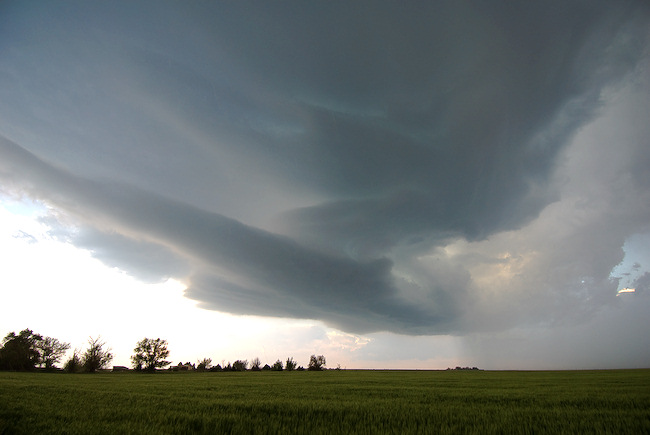
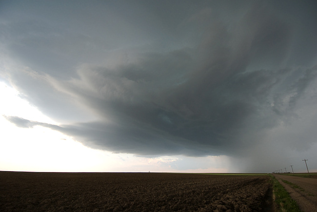
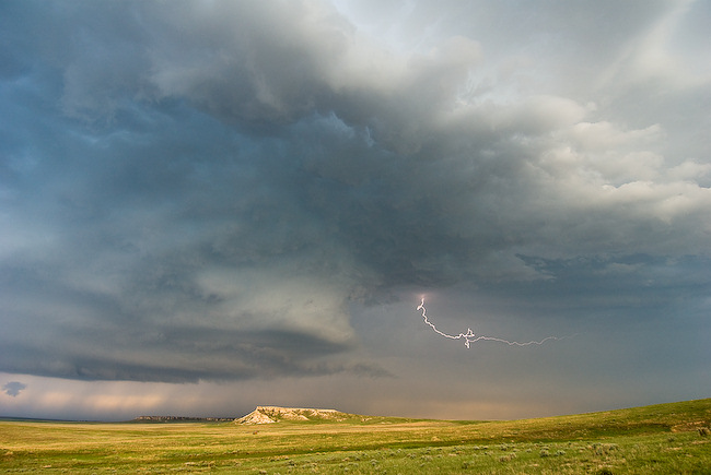
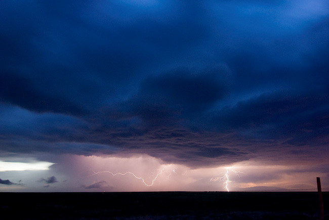
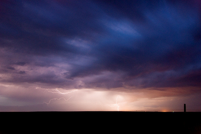
A supercell finally formed off to my southeast, and I bolted west on I-80 to a south option about 8 miles west of Pine Bluffs. The storm showed some pretty good structure once I got far enough south. I followed this storm east and south on unpaved county roads through the Pawnee National Grassland. I stopped at a location east of Grover where I had a neat landscape with a few buttes in the landscape with the storm off in the distance to the north. I managed to get a couple of cloud-to-cloud lightning images with the storm structure and the landscape with the Lightning Trigger. I tried to get east of the main updraft area, but wasn’t having much luck. A new severe storm was forming northwest of me, and I decided to wait for it for some more lightning images. I photographed some long exposure structure + lightning for awhile in the southern part of the Pawnee National Grassland (north of Raymer). I finally called it a chase at around 10pm mountain time, and headed south to Brush for the night.

Great pictures there Mike.
Comment by Nelson - Shawnee County — June 6, 2008 @ 2:45 am