Two Mid-Late Evening Supercells: Roby to Anson to Nugent, TX
Here is part 2 of the two-part chase account for May 1st, 2009. After the Rule to Stamford supercell dissipated, I remained in Jones County near Lueders watching struggling towering cumulus to my immediate north and northwest {2342}. The towers showed very little sign of doing anything other than tilting severely to the east in the strong shear, and I really did not expect this localized area of towering cu to do much. After watching a clumping cumulus field on visible satellite continue to grow to my west toward Rotan and Hamlin, I decided to head in that direction. I did like this area due to the fact that it was A) still far enough south of the surging cold front and B) mid 60s dewpoints lurked southeast of the development in the Abilene area. I stopped to refuel in Anson and continued on my way west on Hwy 180 {0009}. There was an east-west line of somewhat aggressive towering cumulus growth with echoes showing up on radar. My plan, obviously, was to target the best of these initial pulses, but my eyes were most set on the western-most of this small area to the north of Roby, near Rotan. There was another storm to the northwest of Rotan, southwest of Jayton, however it appeared to be too far north, too close to the front, and given its east to northeast storm motion, this was not a viable option for a target storm. I did reach Roby and noticed the electrical activity increasing to my north. About this time, radar on Stormlab was showing continued growth of this new storm with a hail icon by 7:32pm {0032}. I decided to drift north of Roby about a mile or so and stop there to photograph {0043). This was a good decision as the storm developed very nicely before my very eyes to my north-northeast.
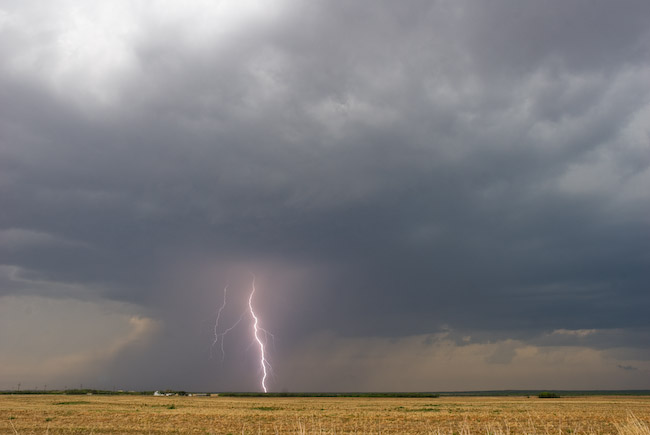
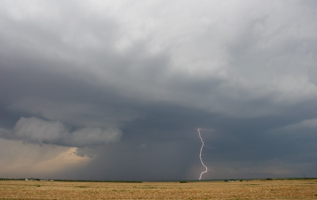
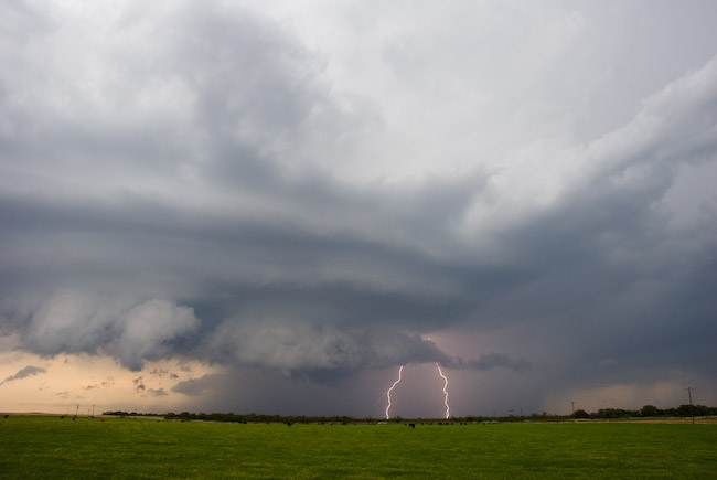
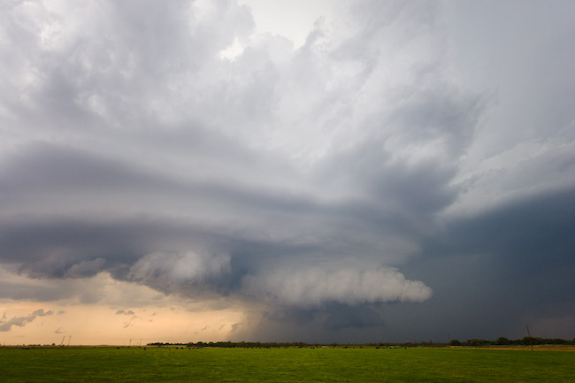
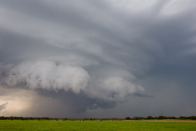
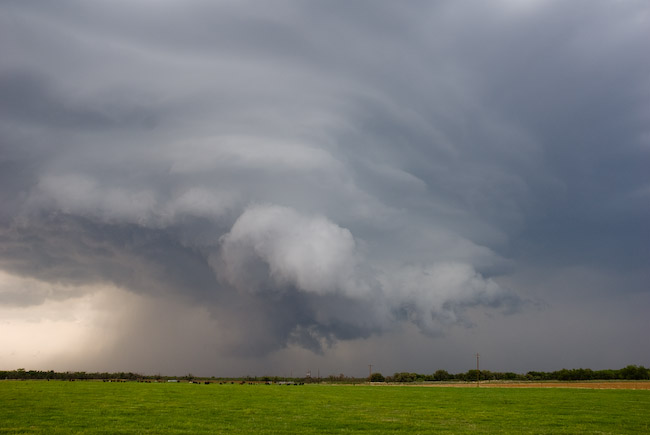
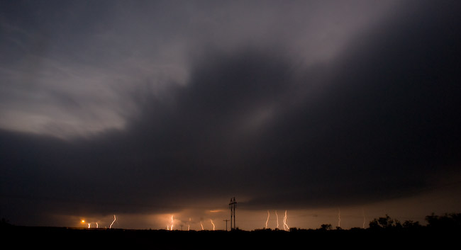
Cloud-to-ground (CG) lightning was photogenic, both within and just outside a concentrated rain core area beneath the storm. I photographed from that spot for nearly 20 minutes — roughly 7:35 to 7:55pm {0056}. Just before I left the location, the storm began to show much better organization, even taking on some supercell structure. I then headed back east on Hwy 180 to follow the storm. Fortunately, it appeared as it right-moved, it would more or less parallel the highway. I stopped again about 5 miles east of Roby along the highway to photograph more. The storm grew into much better structure with striated banding and a mid-level inflow feature on the southeast quadrant {0106}. There was aggressive scud development as well which formed into a wall cloud at times. I set the Nikon D200 on a tripod with the lightning trigger in hopes of capturing a CG with the storm structure. I succeeded. Some cows roaming in the pasture in front of me provided a nice little foreground element addition to the scene. I sat there at that location until a couple minutes before 8:20pm. This would be the best structure this storm would have to offer, for as I continued east…the storm began a slow decrease in intensity as it headed east. All this time, another supercell was developing nicely to my northeast near Haskell {0133}. I stopped one more time to try to photograph dangerous staccato CGs being spit out from my slowly dying storm to the northwest…but the lightning was too close and too dangerous to get out of the vehicle…so after sitting there for a few minutes, I decided to hell with that storm and continued east back to Anson.
By this time, though, it was starting to get dark, and there was no way I’d be able to intercept the new Haskell supercell with any daylight left {0147}. I was still going to follow this storm, though, since it was an extremely easy intercept, plus I had my eyes set on Abilene for a place to stay for the night. This storm was very electrical off to my northeast and was quite impressive on radar {0201}. A couple of other storm chasers closer to this storm reported low, rotating wall clouds at times east of Stamford. Eventually, as this storm approached Hwy 180, other cells began to develop on the southwest flank and the storm became this giant monstrosity of a storm with an incredible amount of CG lightning (both visually and what I was seeing on the Stormlab display! {0242}). I managed to get some CG stills, but nothing all that jaw-dropping. I had a hard time finding an area to concentrate on since there was so much electrical activity everywhere.. it was quite impressive. There was a lot of lightning upstairs, too, and combined with increasing low cloud cover ahead of the storm, made for an interesting “strobe” effect, although sucky for photography. Eventually, I made it to Hwy 351 where I dropped southwest to get into a better position for the storm, the core of which was still off to my northwest at around 10pm {0300}. The storm re-organized into one coherent “blob” of a supercell with a decent mesocyclone, but the visibility sucked where I was, and the hilly terrain northeast of Abilene didn’t help matters either. I was getting kind of tired at this point, too, so I was becoming increasingly impatient with this storm. About halfway to Abilene on Hwy 351, I lost internet connection, which tested my patience even further {0305, the last upload until I got to Abilene). As the storm got closer, I did notice a few instances where distant lightning revealed what appeared to be a concentrated rain-wrapped area of interest, however the lack of frequent lightning illumination prevent good observations.
At about 10:30pm, I called the San Angelo office and talked to my former WFO-DDC colleague Mike Lacy about the storm, relaying to him my observations. He was telling me the best circulation was somewhere between Hamby and Nugent. At that time, I was just on the outskirts of Abilene, so after hearing of this, I decided to backtrack northeast on Hwy 351 toward Hamby to see what I could find. CG lightning around the area of interest was lacking, and low cloud cover around was not helping me figure this storm out one bit. I felt a light northeast wind and eventually noticed a lot of low scud approaching me. I came to the incorrect conclusion that what I was witnessing was near the area of rotation on radar that Mike was telling me about, and given the northeast wind, thinking this thing was either outflow dominant or undercut by the front, so I was not excited about tornado prospects. I say “incorrect conclusion” for this reason: A tornado DID eventually form about 20 minutes after I made this observation…not more than a few miles northeast of my location on Hwy 351! Since I thought the storm was outflow dominant at the time, I packed it in for the night and headed back to Abilene shortly after 10:30pm. What I was observing at that time around 10:30pm was activity along the rear-flank gust front that was approaching my location. The true area of significant rotation was well back in the occluded portion of the supercell, in an area I just simply couldn’t see given the low clouds around and lack of good lightning illumination. I learned of the ~ 15 minute tornado northeast of Abilene from storm chaser Colt Ray Forney who managed to successfully document the event after 11pm as he was positioned on Ranch Road 604 {0418, after I was already in my motel room in Abilene}. I was totally oblivious to this event even a couple days after it happened! Oh well. The tornado he photographed was somewhat wrapped in rain, however it was a fairly stout looking tornado during its mature stage with a fairly nice rope-out he also managed to photograph in the few lightning flashes that occurred. All in all, this was a fine chase day with a number of keeper images for my portfolio ![]()
