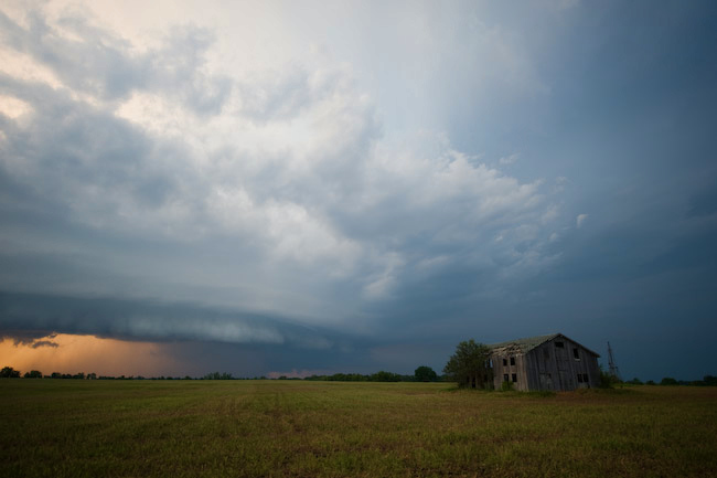
Pawnee City, NE Supercell & Oregon to Amity, MO Supercell
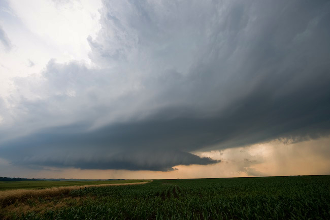
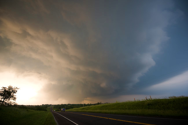
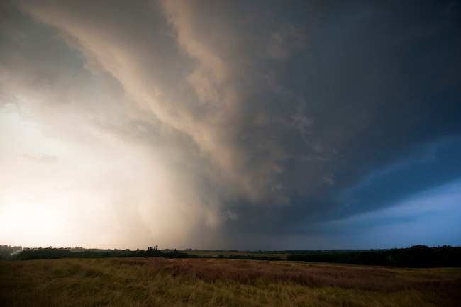
Robin and I left North Platte around 9:30am with a target of Hebron, NE in mind. I really didn’t envision us ending the day along the I-35 corridor in northwestern Missouri, though! …but it was worth it. We photographed two photogenic supercells, the first of which developing near the KS-NE border southwest of Pawnee City. This storm showed some signs of tornadogenesis early on when it was southwest of Pawnee City, however it struggled against some of its own outflow. Nevertheless, this was probably the most photogenic supercell I’ve photographed in southeastern Nebraska. We had a decision to make as we continued east on Hwy 8 on approach to Salem and Falls City — do we continue our intercept of the original storm or do we go after much better looking development east of us — a much more difficult intercept. The atmosphere made the decision for us. The southern supercell took over while our original storm was falling apart. The backside of the southern supercell was spectacular. The convection was like an atom bomb going off in front of us. As we crossed the Missouri River at Rulo, we continued to get closer, approaching the hook echo region of the supercell from the back side. We got into some of the precipitation as we approached Oregon. None of the precipitation was hail…. but as we drove into Oregon, that’s all we saw on the ground. Lots of giant hail. We didn’t stop in town in favor of trying to get ahead of the storm, but in retrospect, I wish we would have stopped to photograph some of these hail stones. They were absolutely huge, and we didn’t miss this hail fall by much — maybe as little as 5 to 10 minutes.
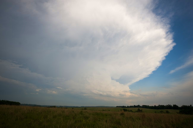
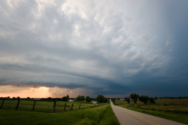
We reached I-29 with the hail core just barely to our east, and we managed to make it to Hwy 36 at St. Joseph where we continued east. We then headed north on Hwy 6 toward Clarksdale where we refueled and continued on our way. We stopped a couple miles south of where Hwy 6 curved to the east (about 6 miles west of Amity) where we photographed the supercell structure and wrapping rain curtains. The wrapping rain curtains to our NNE was significant. There was likely a substantial ground circulation amidst this wrapping rain curtain area, but it could not tighten up into a tornado circulation. It was close, though! We back-tracked to Hwy 36 and continued east, stopping at times to photograph the structure to our north. This was some of the finest storm structure I’ve ever seen this far east — certainly the best Missouri storm structure I’ve photographed. I was impressed — it was almost like chasing a storm on the High Plains — very contrasting colors with good visibility. As we approached I-35 it was getting to be close to 9:00pm and we had to end the chase given the drive we had to make back home. I had a very fun time these past 3 days chasing with my good friend Robin Lorenson. Certainly another reminder for sure how much easier it is to multi-task having a chase partner — since I chase solo so often. Thanks Robin! Some images from this chase below: