High Plains Drifter


disclaimer:  "The meteorological views/forecast thinking expressed are those solely of the author of this blog
and do not necessarily represent those of official National Weather Service forecast products,
therefore read and enjoy at your own risk and edification!"

June 2, 2006

Chase Trip 2006: Day 10- Mount Evans, CO (sightseeing, no chase)

Filed under: Chase Trip 2006,Storm Chasing — Mike U @ 7:54 am

Jay, Jon, Rob, Mitch, and I left Goodland yesterday (6/1) morning and set out for Colorado Springs for what we thought might be some interesting storms along the I-25 urban corridor by late afternoon/early evening. When we got to Colorado Springs, the moisture was mixing out into the lower 40s. The RUC and NAM models were too aggressive with moisture. We blew the chase day off and decided to drive up into the mountains.

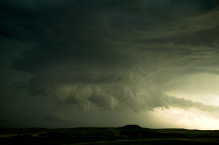
We drove up Mount Evans road, which had just opened up recently. This is the highest paved road in North America reaching the summit of Mount Evans at around 14,200 feet. When we got up there, a picturesque storm was visible to the south-southeast near Pikes Peak area. This storm took on some interesting Cb structure with a lowered base, a slight backsheared anvil at one point, and even a nascent overshooting top. Not bad!

_DSC4009.jpg

This morning we are in Idaho Springs. Mitch will be flying out of Denver today to go back home to Houston. Rob, Jon, Jay, and I will now figure out what to do the rest of our vacation, as it appears chasing opportunities are going down the drain. There is slight hope at something in South Dakota on Saturday, but it looks marginal. We might make another mountain sightseeing day out of today then begin a trek back towards Dodge City?

June 1, 2006

Chase Trip 2006: Day 9- Northeast CO/Northwest KS (supercell & dusty HP beast)

Filed under: Chase Accounts,Chase Trip 2006,Storm Chasing — Mike U @ 8:05 am

Wow, what an action-packed chase day yesterday (5/31)!  Jay, Jon, Rob, Mitch, and I left Clayton, NM by 11:30am or so and headed north through Lamar to Limon.  We arrived in Limon as a supercell was underway to our northwest.  The storm was still in an organizing state to our northwest.  We drove north of Limon to photograph some of the high based structure that had a meso embedded in it to our west.

_DSC3642.jpg

We followed this storm as it cycled through stages of organization north of I-70…then along the I-70 corridor from Bovina to Flagler, CO.  By the time we approached Flager, our storms were becoming a mess.  There was an isolated supercell to the northwest near Fort Morgan which I was tempted to intercept since at the time it was the best looking thing around.  It turned out this was a good idea NOT to chase… as our original activity was about to undergo some significant changes for the better.  We drove through the core of a cell to our immediate east and south that had some dime size hail.

At Burlington, we optioned south just to get into some clear air so we could “breathe” a little easier with respect to staying ahead of all this stuff.  As we went south on US-385 we eventually got far enough south to see some impressive mid level structure with the one cell to our immediate west that had a little meso with it.  This whole area from southeast of Burlington down south to west of Cheyenne Wells, CO was exploding into an impressive HP beast churning up a ton of dust with small scale vortices (gustnadoes) along the gust front.  The gust front wasn’t really surging east that far from the developing updrafts… therefore some of the gustnadoes almost appeared as if they were hybrid front-flank weak tornadoes.

There was really interesting cloud base rotation at various portions along this inflow/outflow interface where the new updrafts were going up vigorously.  At these locally enhanced areas of rotation, the dust would organize in a column and rise up to meet the cloud base rotation.  Really, really interesting!

We actually took a dusty farm road east through all this stuff… north of Hwy 40 between Cheyenne Wells and Arapahoe.  At various points along this adventurous dusty drive, the visibility went to ZERO in dust with northwest winds around 40 to 55 mph or so.  Jon and Mitch were shooting video during all of this and I’m looking forward to seeing how that turned out.

We got back to US-40 and blasted east to Weskan, KS.  Near Weskan, we looked off to the north into the notch of this HP beast.  There was an impressive column of dust that looked better than any other dust column we had seen and it was right where radar was indicating strong shear.  It’s possible we were looking at a weak tornadic circulation back in the notch.  I was able to get a couple photos of this while we were driving east, but it’s fairly inconclusive as to whether this was really a tornado or just a well developed gustnado.  Probably a hybrid?

_DSC3757.jpg

_DSC3758.jpg

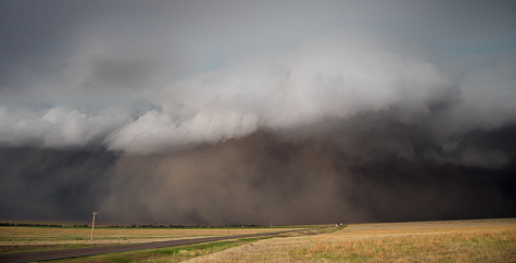
Eventually, this whole thing became one giant dust storm at the leading edge with haboob characteristics at the front edge.  When we got on the east side of Sharon Springs as this monster storm approached Sharon Springs… the structure was magnificent!  It was just a huge wall of updraft right above the dust wall/haboob.  Wow!  I was fortunate enough to capture all of this on the digital SLR.  It was an awesome sight!  We finally aborted the chase northeast of Wallace and backtracked through the storm back to Goodland where we stayed for the night.

_DSC3792.jpg

_DSC3836.jpg

Here’s what my Jeep and Jon’s Cavalier looked like after our zero-visibility dust pursuit… caked with northwest wind-blasted dirt:

_DSC3865.jpg

_DSC3869.jpg

May 31, 2006

Chase Trip 2006: Day 8- Northwestern Panhandles (supercell & other outflow dominant storms)

Filed under: Chase Accounts,Chase Trip 2006,Storm Chasing — Mike U @ 7:56 am

Jay, Rob, Mitch, Jon, and I left Dodge City around 1:30pm and headed west to Lamar, CO. We were undecided as to whether to play the Palmer Divide or the Raton Mesa as both looked pretty good for a supercell thunderstorm. When we approached Lamar, a check of the latest data revealed that the Raton Mesa area to our south had higher CAPE air (more instability). Both areas had about the same shear. At Lamar, we headed south towards Springfield, CO as storms were beginning to form south of Kim, Colorado on the mesas along the NM-CO state line.

We decided to intercept this storm west of Campo. We headed west about 15 miles and approached the updraft of this storm to out west-southwest. There, we met up with Al Pietrycha and Dave Floyd from Goodland. Dave had some bad luck blowing not one, but two tires on this road we were on. After helping Dave out getting back on the road, we backtracked to the east towards Campo. Along the drive back to Campo, our storm was becoming better organized, with a decent wall cloud to our southwest.

_DSC3535.jpg

It didn’t take long for this storm to become outflow dominant. Soon, more storms were forming to our immediate southeast through southwest. With timely radar updates on the road, we decided to core punch this mess to get on the south side. We finally made it to the other side just north of Boise City. (on the radar images, the circled dot indicates our GPS location)
screenshot1a.jpg

Our storms were organizing into a linear system with a well-structured shelf cloud. We found a spot to photograph the shelf cloud about 3 miles south of Keyes at the intersection of Hwy 171 and 64. (radar below at the time of the photograph)
_DSC3572.jpg

screenshot2a.jpg

We then continued south to intercept the tail-end storm of this line which revealed some supercellular characteristics, but the storm fought a losing battle with cool outflow from the storms to the immediate north.

_DSC3611.jpg

We ended the chase near Dalhart and headed to Clayton for the night. All in all, another pretty good storm photography day, so I’m happy.

_DSC3614.jpg

May 30, 2006

Chase Trip 2006: Day 7- Southwest KS (photogenic sunset storms)

Filed under: Chase Accounts,Chase Trip 2006,Storm Chasing — Mike U @ 7:57 am

Jay, Stacie, and I left Lawrence around 1pm and headed for a target area around the Hutchinson-Newton vicinity. We met back up with Rob, Mitch, and Jon in South Hutchinson at a roadside historical marker at the intersection of Hwy 96 and 50… where we awaited convective development in our target area for quite awhile. A large multicell complex of storms had developed well to our south near Alva, OK which was about 80 miles from us. We decided to forego this in hopes of development closer to our west.

After becoming increasingly impatient, we decided to drop south as the towering Cu to our immediate west and northwest just weren’t doing much. We intercepted a small complex of three storms in northeastern Pratt County, two of which were right-left split members that broke off before we got to the area. The left split which was moving just west of due north…was the healthiest of the three. We headed north through Langdon after we drove south about 20 miles…then back west. The storms just weren’t all that photogenic as observed from the east. We decided to get west of the storms and shoot the backside of them as sunset approached.

The left split soon died, but we were rewarded from our decision to move west…as the sky from north through east through south was very photogenic with beautiful mammatus and a golden wheat foreground. This is why I love Kansas! I had a very unique sunlight ray phenomenon (called an anticrepuscular ray) that lit up the eastern horizon in a vertical triangular column. It was extremely impressive and I was fortunate enough to capture this with nice foreground.

_DSC3456.jpg

_DSC3478.jpg

After hanging around here along Hwy 50 in Stafford County, we decided to continue west back to Dodge City. A new storm was developing just west of us which began to take on beautiful colored structure. The colors were just incredible! I couldn’t believe it.

_DSC3506.jpg _DSC3512.jpg

We stopped again to photograph this little storm… then headed west some more before stopping one more time to photograph the Cumulonimbus looking back to the east after sunset as these new storms were becoming better organized.

_DSC3521.jpg

This morning, Day 8, we are in Dodge City. Stacie’s last day was yesterday, so she had to begin here drive back to Fort Worth this morning. Jon, Rob, and Mitch are at the Super 8 here in Dodge and Jay’s here at my place… It’s been storming here in Dodge since about 5 am. A lot of rain and thunderstorms in western Kansas this morning.

It’s still unclear where we’ll be heading today. I’m liking Southeast Colorado upslope by early this evening. This is subject to change, however.

May 29, 2006

Chase Trip 2006: Day 7 Chase Target

Filed under: Chase Forecasts/Outlooks,Chase Trip 2006,Storm Chasing — Mike U @ 10:25 am

Stacie and I are at Jay’s in Lawrence.  We drove all night down I-29 from North Dakota and arrived in Lawrence around 8:30am.  Rob, Mitch, and Jon all went to Jon’s place in Olathe, so we are temporarily away from them… but it appears we will rejoin them this afternoon in our target area around the Hutchinson-McPherson area.

A remnant cold front will continue to stall out over this area today.  Pretty good heating will occur on both sides of the boundary and if any strong updrafts can remain rooted right on this boundary, then non-mesocyclone tornadoes can be possible if things pan out right.  This would be the only hope at a tornado today.  Several of the components necessary for these types of events will be in place today.  Storms should be moving quite slowly, thus significant updrafts should have an easy time developing/feeding on mature storms.  In fact, if a marginal or bonafide supercell develops today, it would likely move south or perhaps slightly west of due south… not unlike July 9, 2003 Reno-Kingman county non-mesocyclone tornado event.  We’ll see how it plays out.

We’ll depart Lawrence probably around 1pm.

Chase Trip 2006: Day 6- Far northeastern ND (marginal LP supercell)

Filed under: Chase Accounts,Chase Trip 2006,Storm Chasing — Mike U @ 1:21 am

Jay, Stacie, and I are currently on I-29 heading south between Fargo and Aberdeen at this time. Jon, Rob, and Mitch are behind us about 10-15 miles. Day 6… what a day of decisions. We left Bismarck with a target of south-central SD in mind. We drove about 30-40 miles and Jon Finch called asking if we were chasing the Devils Lake, ND area today. I told him no, because we needed to get south for logistical reasons. After Jon called, we actually started interrogating this area for a kicks and giggles. It looked really, really good to us. We were trying to figure out why we would want to blow off a very convergent low center area with upper 60s dewpoints and nice southeast to east southeast winds…along with an outflow boundary. After talking this possibility over with Rob, Mitch, and Jon, all 6 of us decided that we couldn’t resist this area. It was actually the closest target to our location at that time.

We turned around before we got to SD back north on US83 — target of Devils Lake. The ob was persistently very good at Devils lake in the mid 80s with upper 60s dewpoints and a southeast to east southeast wind. The only thing that had us worried… and was quite risky…was the lack of upper level flow and the proximity to the Canada border. Storms would be moving with a pretty decent northerly component.

After a lunch in Devils Lake, we hung around at the shore of Devils Lake awaiting initiation of storms. A small storm did eventually develop… leading to a fairly picturesque LP supercell near Cando. As this storm developed, however, the old outflow boundary was pushing back to the south into our area with northeast winds and stable air. This killed any possibility of tornadoes. The base on our storm was high to begin with. This storm eventually suffered a quick death given its small overall size. Other similar storms tried to go up southeast of this original storm, but failed. The outflow boundary was just too much for this area. It didn’t simmer enough north of the boundary, and this was a significant failure component.

So, we ran into Tim Samaras, Joe Golden, Carl Young, and company before we got to I-29 about 17 miles south of the international border; sharing the laments of the pitiful 2006 chase season up to this point. It’s always fun to run in to other chaser friends at various points during the trip.

[~2.5 hrs later...]

I-29 now exit 114 South Dakota. It was 83 degrees a few minutes ago and quite windy at that last pit stop… we may have had a bit of a heat burst from some dying storms, I guess. We noticed lightning to the southwest about an hour earlier which had diminished. Listening to Art Bell right now; it’s helping keep Jay going :)

Here’s a photo of the LP marginal supercell from yesterday’s chase near Cando:

_DSC3442.jpg

Now here’s an interesting photograph. Jon’s car is an essential feeding frenzy for a large conglomeration of flies, bees, and other small flying critters. A gourmet of an assortment of splattered dead bugs attracted all these flies and bees… yeah, rather unpleasant, but had to document this feeding frenzy:

_DSC3424.jpg

For Day 7 (Monday 5/29) we are targetting the tail-end of the front where a pseudo-triple point of sorts may set up in south-central KS. This target will be on the edge of moderate 500-250mb flow, but CAPE should be high and convergence appears to be strong enough according to the NAM model to get a storm to go up… although it may be late. If not, then we just drive back to Dodge for the night, so Stacie can begin her trek back to Fort Worth. Dodge City appears to be a good location to setup for Tuesday’s chase from western OK to northeastern NM. More later from this kamikaze drive, perhaps!

May 28, 2006

Chase Trip 2006: Day 5- Central ND (supercells)

Filed under: Chase Accounts,Chase Trip 2006,Storm Chasing — Mike U @ 6:50 am

A much better chase day on May 27th in North Dakota!  We intercepted storms northeast of Bismarck, one of which becoming a meaty supercell between Wing and Regan.  The structure on this supercell was quite nice.  We followed this north until it weakened, and as it shriveled up, there was visible rotation at cloud base…with even a nascent funnel it appeared looking WSW towards the shrinking updraft area near the Florence Lake NWR.  At Denhoff we travelled west to catch the backside of these storms.  We almost drove into a 72 VIL core (golfball hail or larger), but thanks to a timely radar update, we obviously reconsidered going south on Hwy 41 at Mercer… and optioned farther west dropping south on 200 Alternate to Washburn.  The backside of the supercells were very photogenic with just incredible deep saturated colors of pink, violet, blue, orage… you name it.  It was stunning color contrast right at sunset.  We ran into very brief quarter size hail just northwest of Wilton then decided to stop off at the intersection of Hwy 83 and Hwy 36 to photograph lightning from the southern most supercell that was over Mandan-Bismarck.

We are in Bismarck this morning and plan to leave here probably around 10am for a target near the SD-NE line west or northwest of Valentine, NE?

_DSC3299.jpg

_DSC3307.jpg

_DSC3362.jpg

_DSC3404.jpg

_DSC3410.jpg

May 27, 2006

Chase Trip 2006: Day 5 Chase Forecast

Filed under: Chase Forecasts/Outlooks,Chase Trip 2006,Storm Chasing — Mike U @ 11:50 am

Stacie’s driving so I get to browse the internet here as we are driving on I-94 towards BIS. We left DIK about 40 mins ago… looks like we are driving into the warm sector now. Nice low strato-cu poleward of the front, indicative of the adequate moisture in place. With strong cyclogenesis over WY today, I think our front will be undergoing slight frontolysis, but not enough to prevent the adequate convergence for initiation just west to northwest to north of BIS. Will hang in Manden probably. I hope the storms can move northeast of the Missouri RIver early enough. Upper winds are lacking, but good directional shear from BL to 6km… thank goodness for that. I expect HP end of things today with the weak mid-upper winds.

Just got off the phone with Jon… Rob, Mitch, and Jon are now at Fargo, ND and are about to head west towards Bismarck. So they are now on track to meeting up with us around or just before initiation time.

Chase Trip 2006: Day 4- Northwestern SD (non-severe storms)

Filed under: Chase Accounts,Chase Trip 2006,Storm Chasing — Mike U @ 8:38 am

I’ll try and make this brief, since I need to do a forecast for today’s chase. We are in Dickinson, ND this Saturday morning. We left Gillette, WY yesterday afternoon and followed high based, non-severe storms from the Belle Fourche area north to near the North Dakota state border south of Dickinson. There just wasn’t enough moisture to sustain good, organized severe storms/supercells. It was pretty much a bust, for I thought we’d at least see a picturesque supercell. Oh well. My website is currently having some issues, and I’m lucky to get this blog update out, if I can. I’ll try and post pictures soon if the site can come back alive.

Today (Day 5), we are targetting an area between here and Bismarck it appears. The RUC breaks out storms in this area along a stationary front extending southwest to northeast across ND… from a deep surface low over Wyoming. Unclear what kind of storms we’ll be dealing with, but there’ll be higher CAPE today.

Here are some photos from yesterday’s chase:

_DSC3168.jpg

_DSC3217.jpg

_DSC3204.jpg

May 26, 2006

Chase Trip 2006: Day 4 Chase Target Forecast

Filed under: Chase Forecasts/Outlooks,Chase Trip 2006,Storm Chasing — Mike U @ 8:15 am

Morning analysis shows a sfc low near Miles City with lower 50s dewpoints in northeastern MT. Looking at the 06z NAM, it appears this first sfc cyclone will continue moving northeast into western ND….with a weak front moving south into far southeastern MT by early afternoon. As this is happening, significant mid level flow perpendicular to the Big Horns will support pronounced lee cyclone development downwind of the Big Horns. The NAM has been showing this for many runs. Looks like that front will stall along a line roughly from Sheridan to Broadus to Capital. Winds east to northeast of this boundary will advect in near 50 dewpoints in this area it appears. 87/50F sfc parcel supports about 1300 to 1500 J/kg CAPE along this axis from Broadus to Capital by 00z. The shear profile looks very good with a broad looping hodograph in the 0-6km layer. This environment certainly supports supercells. Looks like we may head north to Broadus this afternoon.

« Newer PostsOlder Posts »

Powered by WordPress