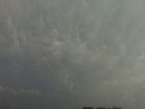
From the Gove county storm at 653pm cdt
disclaimer: "The meteorological
views/forecast
thinking expressed are those solely of the author of this blog
and do not necessarily represent those of official National Weather Service forecast products,
therefore read and enjoy at your own risk and edification!"
and do not necessarily represent those of official National Weather Service forecast products,
therefore read and enjoy at your own risk and edification!"
May 23, 2010
Into kansas
Time, 5:22 Central, I am just south of Alma, Nebraska, continuing south to interstate 70. There is towering cumulus clouds on satellite in Trigo County. Actually, all along the line, extending southwest and Northeast from there. We will just drive south and hopefully a storm will form along I-70 around __ or thereabouts or later.
[ Transcribed by MyCaption ]
On the road toward home
I left Aberdeen at 9:30 Central Time, heading south Long Drive to Western Kansas. There is a severe weather risk across Western Kansas, and by the time I reach that area this evening, storms will likely be going. I’m really not intending to chase today, but storms will be developing on the way home, so it might get me an opportunity to photograph a little bit before I head back into Dodge. I go back into work tomorrow morning. More later.
[ Transcribed by MyCaption ]
Out of the mud
I am successfully out of the mud. What an ordeal. Sean experience I wish to never repeat. But I’m back on pavement and two other chasers still have their vehicle still out in the farm fields stucked and from what I understand, those vehicles may not be recovered until perhaps, Monday. So, we were not take care of a few last minute bangs with regards to this circumstance that I was involved in and I’ll be making at the Pierre really late probably about 4:00AM, maybe. But everything else is okay. Again, an amazing, amazing storm chase.
[ Transcribed by MyCaption ]
May 22, 2010
many chasers stuck, but tractors are on the way
well, jeff piotrowski joined us at our mass stuckage… he got stuck
on that road that dead ended. MANY chasers are stuck… apparently,
Jeff P said that there are 4 tractors coming to rescue all of our
vehicles… unbelievable how many chasers were succumbed to the
“Delorme Moment” or “Streets and Trips” moment. Unreal! More later
when there’s more infol
northwest of Ipswitch… road dead-ended with tornadoes coming at us.
I am currently in a situation I’m not sure how I’ll end up getting out
of. I am okay, but the farm road I was following dead-ended with the
tornadic supercell coming straight for me… well us… because there
are 6 other chase vehicles stuck in a drenched farm field northwest of
Ipswitch. Tornadoes were bearing down on us, and it was a fog of
war.. we didn’t know what to do… it was the worse-case scenario
situation… dead end road with no escape route and the bears cage
coming right at you. There were several tornadoes dancing about the
fields northwest through west coming in our direction…. in a last
ditch move, we all decided to head south into the farm field to escape
the tornadoes… which we did…. but now we are all stuck … I think
all of us are… it’s still raining… I never anticipated this…
otherwise, this was an incredible chase day… amazing images…. but
first thing’s first… how do I get my Jeep back on pavement? I’ll
keep you updated… at least I’m in company!
Photograph the large tornado as it crossed highway 47 to the west, southwest of Bowdle. Damage on highway 47. Power pulled over the road. Road impassable 1.5 miles south of highway 12. More later.
[ Transcribed by MyCaption ]
Storms about to develop
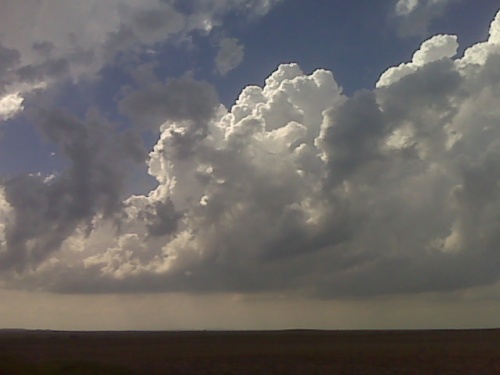
Looking wnw from north central south dakota. Tornadic supercell is likely in this area this evening
chase update may 22 3:35pm cdt
I am currently located along Lake Oahe west of Gettysburg, SD. A
dangerous convective situation is about to unfold around this area.
SPC mesoanalysis shows 5000 J/kg of surface based CAPE and a couple
hundred joules of 0-1km SRH which computes to an EHI of over 7.
Strong tornadoes are very possible, if not likely, in this environment
if a surface based storm forms in this area… which pretty much all
the models suggest happening. The area along the SD-ND border east of
Mobridge appears especially vulnerable during the evening hours. I
will stay on the east side of the Lake and watch things bubble to my
west… as it appears to be doing as I type. It could be a long
evening.
Chase update may 22
Time is 2:38 PM Central, heading north Pierre, South Dakota. Convergence of moisture induction is all focused just northwest of Pierre and is drifting north so I will head north from Pierre and initiation of storms should occur over the next couple of hours, North, Central and South Dakota looks good.
[ Transcribed by MyCaption ]