High Plains Drifter


disclaimer:  "The meteorological views/forecast thinking expressed are those solely of the author of this blog
and do not necessarily represent those of official National Weather Service forecast products,
therefore read and enjoy at your own risk and edification!"

January 11, 2008

New Year’s Update

Filed under: Uncategorized — Mike U @ 9:17 am

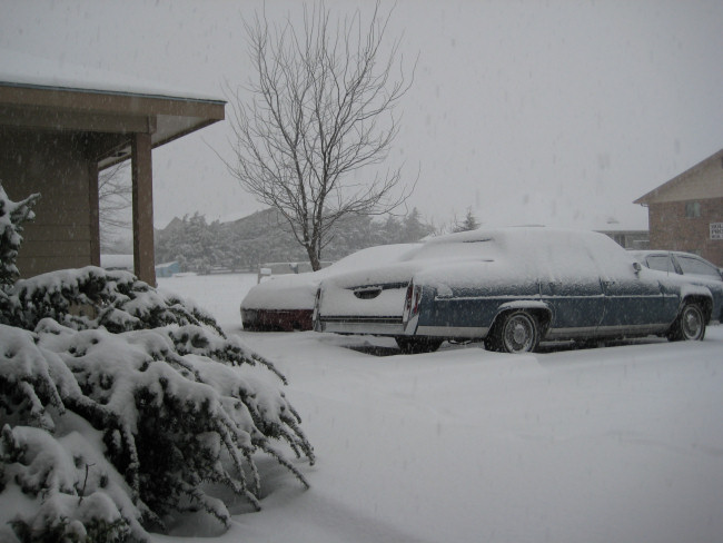
I haven’t posted in the blog in awhile, so I thought I’d give my readers a brief update on things.  I recently got back from an awesome trip to Florida (first time there!) to watch our KU football team give an impressive performance at the Orange Bowl.  I went with my longtime friend and college roommate Jonathan Smith.  I uploaded some photos from the festivities.  What a time!

As you can see from that link above, you may notice this new page/format.  I’ve decided to completely re-structure the way I process, organize, and upload my images now — almost exclusively through Adobe Lightroom.  The main reason for this is to save time.  It was just taking too darn long to meticulously process image after image — it was becoming a drain.  That said, I will always take extra care and time to post-process images of importance.  These carefully processed images will ultimately have a resting spot where my Gallery currently resides.  Over the next year or so, image albums on the Gallery will be transferred to "Collections".   http://www.underthemeso.com/collections.  All new shoots from this point forward (actually since about November 2007) will be accessed through "collections".  All the albums will be linked through this repository of mini blog-like posts and also a handy menu system.  Clicking on the thumbnails of each of these small posts will take you to a Flash album.  Also, by going this route, it also allows me to attach EXIF data to the images, which I’ve been wanting to do.  

What about Gallery now?  Gallery will evolve into my portfolio of sorts.  A "best of".  Thus, Gallery will become much smaller in time as a result.  This is a good thing, actually, because I want Gallery to be the showcase for only my best images whether it be stormscapes, landscapes, or wildlife.  This will be my ongoing 2008 project for Underthemeso.com — this sort of restructuring.  Only once I get this pretty much completed to my liking will I finally set up some sort of online store where folks can order prints directly through Gallery.   

I’m going to be very busy through early April as I will be giving talks about Greensburg at a number of conferences/seminars/etc.  Here’s a list of events I’ll be speaking at:

January 29 @ 6pm CST — Wichita/South Central KS AMS — Wichita, KS
February 16-17 — National Storm Chaser Convention — Aurora, CO
February 23 — Douglas County, KS Advanced Spotter Seminar — Lawrence, KS
March 1 – ‘Storms of 2007′ Showing & Fundraising event — Pratt, KS  (date may change, still tentative/in organization)
March 8 — TESSA National Storm Conference — Colleyville, TX
March 12 – Virginia Emergency Management Conference — Hampton, VA 
March 29 — Central Plains Severe Weather Symposium — Lincoln, NE
April 5 — Great Lakes Meteorology Conference — Valparaiso, IN

December 15, 2007

Kansas Snow, Dec 14-15 2007 [post 8]

Filed under: Uncategorized — Mike U @ 9:52 am

10.4" officially as measured at the NWS Dodge City.  Well, this makes it two straight seasons now with at least one 10-inch snow event (the last being April 13 this past Spring).  The wind did pick up with gusts to 25 mph, and given the light, powdery nature to the snow, drifting was very common.  There is two-foot drift on the backside (facing south) of my duplex building.  There’s another long 14 to 17 inch drift in between my Jeep and my neighbors cars out front.  Below are a few photos from the event (click on the thumbnail for the full size version): 


December 14, 2007

Kansas Snow, Dec 14-15, 2007 [post 7]

Filed under: Uncategorized — Mike U @ 10:18 pm

8.3" as of 10pm CST.  The last band of moderate-heavy snow is moving through at this time — about on schedule per the model forecasts.  The measurement in the backyard at the top of the hour yeilded a little over 8 inches!  A northeast wind will be picking up more after midnight, so there will be increased blowing and light drifting of snow through the overnight hours.  A very nice storm!!! 

Kansas Snow, Dec 14-15, 2007 [post 6]

Filed under: Uncategorized — Mike U @ 8:15 pm

Img 1Measured 6.7" in my backyard as of 8:00pm.  We remain in a mid level deformation zone which has kept a southwest to northeast orientation of moderate to occasionally heavy snow bands in the vicinity.  Snow rates continue in the 1/2 to 3/4 inch per hour as of the time of this post.  As I type, there’s a good band overhead once again… so we are probably just over 7" now :-)   This is very nice!!

Kansas Snow, Dec 14-15, 2007 [post 5]

Filed under: Uncategorized — Mike U @ 4:55 pm

Img 1Around 5" now!  Man, I’m loving this!  Radar loop still looking good around Dodge City with narrow intense bands of heavy snow.  The snow has changed a little bit… much smaller flakes, but very numerous.  This is a type of snow that can really accumulate fast.  We may be at 7 or 8 inches by mid-evening… which was the upper end of the forecast.  Here is a radar image below.  I drew some black lines where the intense frontogenetic bands are centered:

Kansas Snow, Dec 14-15, 2007 [post 4]

Filed under: Uncategorized — Mike U @ 3:20 pm

3.3" here at my place in Dodge City.  It’s been snowing moderate to heavy at times since 11:30am…averaging about an inch per hour!  The upper low is still over New Mexico, so we should remain in pretty good lift through most of this evening…until the upper low comes out across the TX Panhandle.  Here is another photo outside my front door:


Kansas Snow, Dec 14-15, 2007 [post 3]

Filed under: Uncategorized — Mike U @ 12:54 pm

A look out the window…  It’s nice and white!


Kansas Snow, Dec 14-15, 2007 [post 2]

Filed under: Uncategorized — Mike U @ 12:42 pm

Img 1Heavy Snow!  It started snowing here in Dodge about 11:30am, and we already have near an inch in the first hour just looking out the window.  SPC issued a mesoscale discussion concerning this heavy snow axis centered just about on top of Dodge, especially the southeast edge of town.  Radar shows some lower 30s dBZ echoes, which translates easily to 1.5 to 2" per hour rates.  Looks like mod to heavy snow for much of the afternoon!  We could see 6+ inches here based on the latest QPF guidance from NAM, RUC13, and Canadian 15km morning model runs.


Kansas Snow, Dec 14-15 2007 [post 1]

Filed under: Uncategorized — Mike U @ 12:16 am

Img 1No rest for the weary following the ice storm.  Bring on the snow!  Nice little surprise setup (in that, I mean we weren’t exactly seeing this nice of a system > 4 or 5 days out) could bring much of southern Kansas a swath of 4 to 9" of snow, including here in Dodge City.  Right now, if the latest 00z runs of the Canadian, NAM, and RUC models verify, we should see 4-6" of snow here in Dodge City.  It looks like impressive lift will be over Dodge from roughly 1pm to 9pm tomorrow… probably maxed out around late afternoon.  A surface low will eventually strengthen to the southeast, so we may see some 20-30mph wind gusts from the north-northeast by midnight tomorrow night as the pressure gradient increases… to help blow the snow around a little bit.  Img 2In Img 1, I show the 500mb (mid level of the troposphere) Height and Vorticity pattern (basically showing the storm in the mid levels) from 3 model forecasts at 24 hours.  A vorticity max (where the colors max out at the base of the height trough), taking a path to the south of Dodge City is favorable for snow here.   These three forecasts look quite favorable.  Img 2 shows the run total snow accumulation forecast from the NAM model.  I hope that verifies!

December 13, 2007

December 8-11, 2007 Ice Storm Summary

Filed under: Uncategorized — Mike U @ 6:43 am

The ice storm of December 8-11, 2007 was one of the more far-reaching ice events I’ve seen.  There were three distinct corridors of significant icing events during this time span of nearly 3 days.  These areas are depicted in the image below, which is a 7-day precipitation map covering the days of the ice storm across the midsection of the country:


Below are a few links of interest related to the December 8-11, 2007 Plains ice storm:

Stormtrack Forum forecast, nowcast, reports: 

WINTER STORM FCST 12/07/07-12/12/07: KS, MO, IA, IL, MN, WI, NE, MI
WINTER STORM NOW 12/08-11/2007: KS, OK, NE, MO, IA, CO, among others
12/9-12/11/07 REPORTS: Plains to Great Lakes 

National Weather Service summary pages:

NWS Dodge City, KS
NWS Norman, OK
NWS Tulsa, OK
NWS Wichita, KS
NWS Topeka, KS
NWS Pleasant Hill, MO
NWS Springfield, MO
NWS Hastings, NE

« Newer PostsOlder Posts »

Powered by WordPress