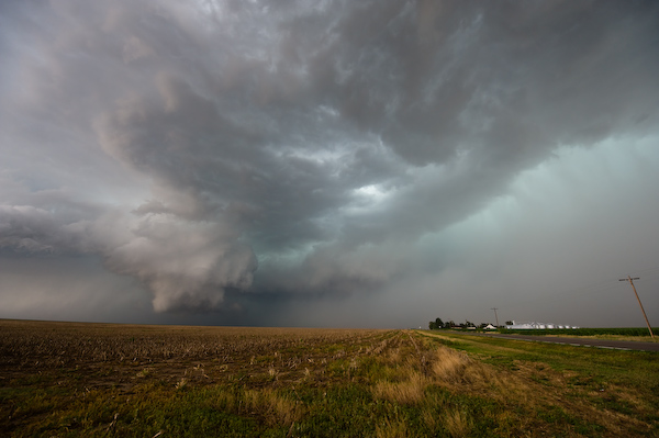
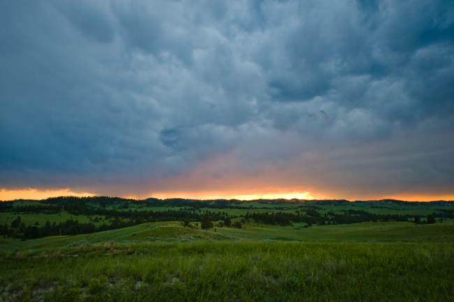
High Plains Drifter


disclaimer:  "The meteorological views/forecast thinking expressed are those solely of the author of this blog
and do not necessarily represent those of official National Weather Service forecast products,
therefore read and enjoy at your own risk and edification!"

November 13, 2008

More Photos of 10 November Johnson, KS tornado

Filed under: Nov 10, 2008,Photography,Storm Chasing — Mike U @ 1:31 pm

Here is another photo of the Johnson, KS tornado at its mature stage.  The image was processed using mainly Levels in Adobe Lightroom and further processed using layers in Paint Shop Pro.  I used Neat Image to clean some of the noise up since I shot this at 500 ISO on my Nikon D200.  (My Nikon D3 is what I am currently using only for ultra-wide angle landscape/stormscape images, which is why all the tornado images were shot using the D200 so I could zoom in more).

There are more images!  I have uploaded an album of 22 photos showing the life of the this rare western Kansas November tornado 


November 10, 2008

Chase Acct: November 10, 2008 [brief]

Filed under: Chase Accounts,Nov 10, 2008,Storm Chasing — Mike U @ 7:36 pm

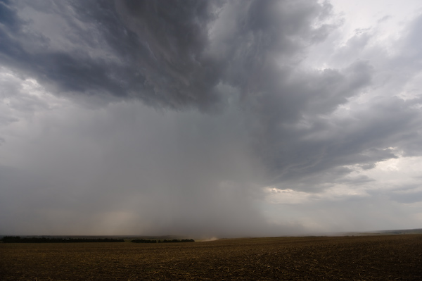
Real brief.  I will write a detailed chase account later on.  I chased and photographed my first November tornado earlier this afternoon at around 3:30pm CST.  This tornado was on the ground for ~ 7 to 10 minutes northwest of Johnson, KS about 3 to 4 miles or so.  I photographed the tornado from Hwy 27 just a couple miles north of town.  Below are two photos.  The first is the supercell storm earlier on about 10 miles SSE of Manter, KS as it was entering Stanton County.  The 2nd photo shows the tornado in its mature, large stage.  It briefly took on a wedge shape appearance, as is shown.  The immediate inflow air into this storm was ~ 53 degrees temperature over ~ 47 degree dewpoint.  Incredible!! 


A November chase close to home?!?

I am really intrigued by the meteorological setup across the far southwest Kansas/western OK Panhandle/extreme northeast NM corridor for later this afternoon.  An intense, yet compact (important!) mid level potential vorticity (PV) anomaly will eject northeast out of New Mexico by midday and become centered across the area mentioned in the first sentence.  This setup has some similarities to the 26 October 2006 setup, although probably not as intense.  Nevertheless, there is the possibility for interesting low-topped, intense convection near the nose of the mid level vort max/PV anomaly where low level convergence/frontogenesis will be extremely favored.  A narrow corridor of 45 to 50°F dewpoint air at the surface may extend northwest as far as Guymon, OK or even points west of there, sneaking into an area with ~ -21°C temps at 500mb.  Since this isn’t all that far from Dodge, I will try to chase this setup and see what I can come up with.  Just the thought of possibly seeing a brief "cold core" setup tornado in November is enough for me to get out the door, however small that probability may be.  I look at the short-term RUC forecast and have visions of 26 October 2006 running in my mind.  This would be a low CAPE event, with forecast CAPE on the order of 300 to 500 J/kg in a narrow corridor, but that is enough convective instability given the degree of focused, intense ascent from this small system at the nose of the mid-level PV anomaly.  Below is a 9-hour RUC forecast:


August 13, 2008

Chase Acct: August 12, 2008 (Southeast Colorado)

Filed under: Chase Accounts,Storm Chasing — Mike U @ 12:59 pm

(Times in CDT).  I had been thinking for a couple days about chasing Tuesday, August 12th on my day off since it appeared to be reasonably close to home.  A strong upper jet was forecast to come across the central Rockies and adjacent high plains — around 60 to 70 knots around 250mb.  So it was this and the expected decent moisture of upper 50s to lower 60s dewpoints across far eastern CO that perked my interest to chase.  The situation just looked promising for good storm photography.  

My target was around Lamar, and I left Dodge around 12:45pm or so after attending a going-away luncheon for one of our forecasters.  On the mesoscale, I was somewhat intrigued by subtle convergence and baroclinicity between Limon and Burlington.  Both Burlington and Goodland were somewhat cool with a 64 dewpoint at 1pm.  Cumulus began to form around the eastern reaches of the Palmer Divide, and soon a storm formed near Flagler along the previously mentioned subtle boundary.  The storm was small and struggled to fully mature, showing attempts at supercell processes on radar as it drifted slowly south-southeast between Flagler and Wild Horse.  I reached Lamar around 3:30 and continued north toward Eads.  New storms were forming south of this initial storm extending down toward the Eads area.  At Eads I went west about 6 or 7 miles to get a better vantage point of the southern most cell of this cluster.  By 4:30, this storm began to take on much better organization to my north. An intense precipitation core developed and spewed outflow with the temperature dropping to about 68 degrees (from 92).  A brief roll cloud developed close to the ground, but it didn’t last long.  

I had to get south, and instead of going back east to Eads to go south on US-287, I optioned to head south on a graded county road.  I took County Road 33 to WW to County Rd 30 which goes into McClave, west of Lamar.  During this stretch of the chase southwest of Eads and north of McClave (from ~5:15pm to ~6:00pm) the storm was due north of me the entire time, and I was in the immediate inflow to the storm updraft.  Inflow wind was from the east-southeast at 25 to 40mph, and it was a struggle at times to open my driver-side door against the east wind.  The inflow temperature was about 86 degrees, and the storm’s cold outflow was not pushing ahead very far at all against such strong storm relative inflow.  The surface storm-relative inflow, with a due south storm motion of 15 to 20 knots was from the southeast at probably 45 to 55 knots! 


This was very impressive and really allowed this supercell storm to thrive for quite some time.  I stopped several times heading south on this county road which was also open range for a good percentage of the drive, and had to slow down for cattle a couple times.  


I reached McClave with a decision facing me where to cross the Arkansas River.  Do I go west to Hasty to continue south or east to Lamar?  The storm did have just the slightest east component to its southward motion, so I made the decision to go east to Lamar.  The problem facing me though was the 16-mile construction zone south of Lamar where there would be up to a 30-minute delay with one-lane road and a pilot car.  I didn’t want to deal with that, so when I stopped in Lamar to get gas, I took a look at possible graded county road options southwest of Lamar to avoid the US-287 construction.   At the time, I didn’t know how far south the construction extended to, so I just planned on staying on county roads as long as the map showed there being any.  


Phase 2 of the chase. SSW of Lamar   The supercell still had almost a due-south motion as it bypassed Lamar to the west.  I got onto graded county roads south-southwest of Lamar and continued the chase.  The storm still revealed very nice high-based structure to my north-northwest.  The east inflow was still impressive at 35 to 40 mph.  Between 6:30 and 7:00pm, the chase was going fine as I was staying ahead of the storm with the graded road working quite alright to the west of Hwy 287.  I needed to get back to Hwy 287 eventually, though.  But where?  One option was County Road L about 20 miles south of Lamar, and the other option was County Road C about 8 miles further south.  Driving all the way south to County Road C would requre driving through a ranch that was on Delorme.  I felt confident at the time that the graded road I was on would make it all the way to Road C, through the ranch.  So that’s what I decided to do.


The above image was taken at 7:10pm on one of the south legs of the graded county road I was following west of Hwy 287 SSW of Lamar.  This would be the last time I would photograph this storm from its inflow south side.  I saw a "Dead End" sign.  I was approaching the ranch.  "Floating W Ranch" on the map. 

Phase 3 of the chase.  Getting cored!  Well I got there, and the storm wasn’t far behind.  Only thing was, while the storm could keep going, I could not!  Now I made this calculated risk because I knew well and good that all the legs of the graded road I was on were very well graded.  It was a very good thing.  I turned around with a nasty looking core bearing down on me.  There was actually a small farmstead I passed only a couple miles before I got to the ranch, so I pulled in the driveway and turned my Jeep into the wind.  I was fully expecting at least golfball size hail given its history.  North winds up to 60 mph knocked down some tree branches at this farmstead, but hail never got any larger than peas, fortunately enough — but it rained like heck.  After about ten minutes of letting the worst of the core go by, I continued the drive back north… at 25 to 30 mph… on the very wet graded county road.  It wasn’t bad at all — very hard surface with large pebbles allowing better traction — this is despite at least an inch of rain just falling in the past 20 minutes.  I made it back to County Road L, which led east to Hwy 287.  The sun was coming out and the rain was still coming down very hard amazingly enough.  A brilliant rainbow resulted.  Rainwater was cascading everywhere adjacent the road I was on.  I came upon a section of this road where some of the water in the adjacent ditch overflowed into the road and was crossing to the other side.  I sat there for about 20 minutes for the water to lower so I could pass through.  Of course, I did a little bit of photography while I waited!


Phase 4 of the chase. Wake of the storm.  The water running through the ditches didn’t take that long to lower, so I continued my merry way slowly east toward Hwy 287.  On the way, the sunlight was lowering and the "golden hour" light was just getting better and better.  I was treated to absolutely spectacular mammatus and post-storm anvil structure amidst the high plains landscape.  The photography of the backside of this storm was just as good — if not better — than from the inflow region.  The immediate wake of storms at sunset almost never fails for fantastic photography opportunities.  In a serendipitous way, I’m rather glad the circumstances played out the way they did for me.  That sunset light was just spectacular — saturated landscape in terms of both wetness and in color with the fading sun! 


I finally made it to US-287 shortly after 8:30pm, and the last of the sunlight illuminated the backside of the storm anvil an orange-pink hue to the south.  The remnant shaded portion of the mammatus-filled anvil still attained amazing contrast and structure.  These were the last images of this chase, and very shortly afterward, I got in line to wait for the pilot car on Hwy 287 south of Lamar.  This was certainly one of the more memorable chases in awhile — and definitely ranks in the top 5 of all my mid-late summer (July-August) chases. 


-Mike Umscheid 

July 19, 2008

Chase Acct: July 19, 2008 (Northwest KS)

Filed under: Chase Accounts,Storm Chasing — Mike U @ 1:11 am

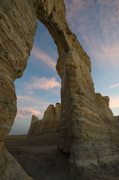
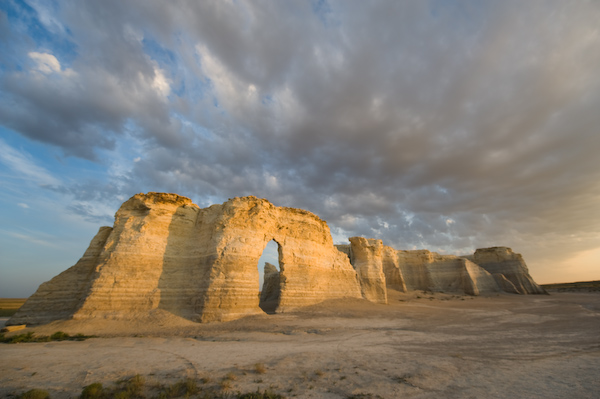
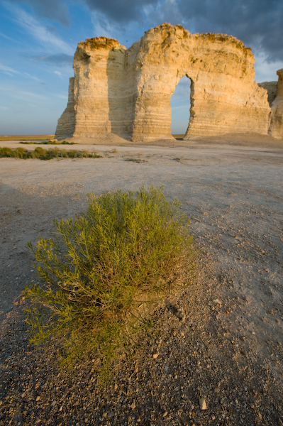
I started this chase at 1:30 am.  Yes.  Since my sleeping schedule wasmessed up, I was pretty much up for good by that time.  With a fullmoon out, I decided to do some moonlit landscape photos at MonumentRocks north of Scott City.  By the time I got there around 4am, though,the moon was getting very low in the sky.  I experimented a bit with"flashlight illumination" of the Monument Rocks formation.  Overall, itwasn’t much of a success, as it’s difficult to spread even amounts ofillumination on such a large subject.  None of the images turned outall that great to my liking.  Sunrise was a little bit better, though,and I got some decent images in the sunrise light. 


Fast-forwarding to later in the day… 

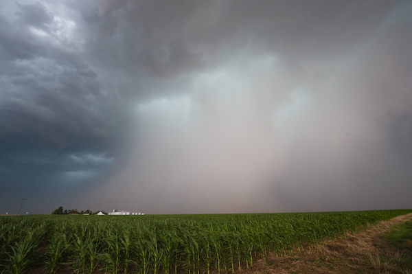
This was kind of a gamble chase — gambling that there could possibly be anything of interest to photograph in terms of storm structure given the crappy summertime flow regime.  It was a gamble that I think paid off, because even though the storms I chased were barely severe, I managed to photograph some interesting storm structure — not necessarily updraft structure per-se, but beautiful, tall, contrasted rain-shafts, impressive rain-foots, and even some small/weak gustnadoes at the leading edge of outflow boundaries.  There was a brief moment of excitement north of Colby when two storms were converging on each other, ultimately forming a decent but brief rotating area when the storms converged.  At this point, a very nice looking and rather low-to-the-ground wall cloud formed — actually one of the better looking wall clouds I’ve seen all year!  It didn’t last long, though, and evolved into an outflow dominant shelf cloud.  I photographed probably 6 or 7 different storms over the span of about 3 or 4 hours from northwest of McCook to Atwood to southeast of Colby.  I witnessed and reported through SpotterNetwork 3/4" or larger diameter hail on two separate occasions – the largest hail witnessed being a piece just barely larger than a quarter just west of Atwood on the back edge of a storm.  I also saw a bunch of small, short-lived gustnadoes along an outflow boundary southeast of Colby.  I got one CG lightning image from the Lightning Trigger and that was it for the entire day from a lightning standpoint.  I got back home just after midnight — thus concluding my nearly 24-hour chase day!  I slept for 13 hours after that :)   Below are a few images from the chase:


July 17, 2008

Chase Forecast — July 17, 2008

Filed under: Chase Forecasts/Outlooks,Storm Chasing — Mike U @ 12:42 am

I will be chasing today, Thursday, July 17th.  It is my two days off between midnight and day shifts which start Saturday.  Obviously, with it being summer, the wind shear setup is less than ideal for long-lived supercell thunderstorms, but the thing today has going for it is a lot of moisture.  As I type, much of western Kansas is soaking in 65-67 degree dewpoints, with a 66 dewpoint at Imperial, NE.  Coincidentally enough, Imperial, NE is my target.  All the models generate quite a bit of convective precipitation, so I am giving today about a 60-75% chance of observing and photographing a severe thunderstorm of some sort in the target area of Southwest Nebraska and adjacent far Northeast Colorado.  Since I am fresh off midnight shifts, my sleeping pattern is F*d up.  My day has essentially begun at 1:30am.  I plan to do some moonlit landscape photography at the Monument Rocks north of Scott City before heading north toward the chase target.  I’ll probably get there late morning which will allow me to grab a midday power-nap of sorts before storms start developing.  

June 27, 2008

June Chase Trip 2008: Back Home.

Filed under: Chase Trip 2008,Storm Chasing — Mike U @ 9:48 pm

Vince Miller and I have arrived back in Dodge City this Friday evening.  We noticed a nice looking storm on the southern horizon which was located over Beaver County, OK.  It had a huge back-sheared anvil and we could see the backside hard convective tower as we neared Dodge City at sunset.  This was indeed a fun trip with a nice collection of new images to go through.  Thanks to Vince for doing all the driving and allowing his vehicle to accumulate even more mileage on his "old reliable" Toyota Camry wagon.  The chase season is over now, but of course I’ll be out again on spur of the moment opportunities (like always) on days off close to home should a summer disturbance move into the area. I’ll be working hard over the next couple weeks to get updated albums loaded to the Image Collection section of Underthemeso.com.

June Chase Trip 2008: Day 9 Summary — Northern & Central South Dakota

Filed under: Chase Accounts,Chase Trip 2008,Storm Chasing — Mike U @ 9:24 am

This was the last day of the chase trip since a strong cold was pushing through the length of the Great Plains shutting off severe weather over the northern plains until next week sometime.  Will post a full account later on today on the road with some images.  It was a fun chase that took us northeast to the Dupree and Eagle Butte area northwest of Pierre, SD. 

EDIT (July 1 at 9:30pm):  The more detailed account is below, including 8 photos from this chase.  -Mike U  

June 26, 2008 — Northern/Central South Dakota Severe Storms and brief "whatever"-nado

Vince and I abandoned Sturgis area once it became apparent that weneeded to get north with the first significant storm developing betweenBison and Buffalo. We were quite aways away, but given extrapolation ofour position and the storm’s track, we would be in position of at leastsomething interesting once we approached Dupree. When we got closer tothe storm, another small supercell updraft formed to the immediate westwith a razor-sharp anvil and rock-hard convection. Soon, an interestingblocky wall cloud formed beneath its base looking toward Meadow, SDfrom a location about 7 miles north of US212 along S73. As this washappening, explosive convective development was occurring to the east.These would be almost impossible to intercept given Lake Oahedownstream. Our storm finally got some beef to it and it began to rollsoutheast from Isabel to Eagle Butte. It certainly looked slightlyoutflow dominant from a distance as it approached, but there was anoticeable kink in the gust front with an embedded meso in theresomewhere northh of Lantry. We drove east on US212 toward Eagle Butteand we observed what we will just call for now a "vortex of debatablename" as loose and dried up vegetative debris from a farm field wasrotating nicely in a tall column just off to our northeast. If you wereto look at this feature from a distance, I would imagine you would beable to see a nice "kink" in the shelf cloud. There was an inflow notchinto this area where our vortex occurred and it was occurring very nearrenewable updraft growth atop the shelf. We weren’t in the best position in the worldwatching this track from our northeast to immediate east to southeastas it crossed US212 in front of us less than a mile east of theUS212/63 junction (the western one east of Eagle Butte).

Atany rate, there certainly was an interesting notch in this gust frontwhere the vortex occurred. And it was this that made me think it was aweak tornado, thus was what I reported on SpotterNetwork. It was neverreally all that violent, but a rear northerly inflow jet (for lack of abetter description) blasted Vince’s car with all sorts of dried upweeds and other vegetative debris… and it was very focused too, withthis stuff blowing across the highway over about a 10-20 yard distance.You could see little fingers of condensation, some of which resemblingwhispy funnels, but who knows what to really call them. How about"thingies"? Or "danglies"? Yeah, those. The vortex resembled some sortof multi-vortex, but quite weak, mess in the dust as it continued tomarch south in the somewhat dusty fields just south of the highwayjunction.

The other excitement of the chase was after dark whenwe observed and photographed a spectacular Cb lightning display to ournortheast, the tail-end storm of the central SD complex — completewith a star-filled sky surrounding the storm. An amazing sight indeed.What a fun chase to end our trip!   Vince does have dash mountvideo of the entire sequence, and after several reviews of the video,we just came to the final conclusion of calling it a "vortex of unknownname". :-)


June 26, 2008

June Chase Trip 2008: Day 9 Forecast — Western SD

Filed under: Chase Trip 2008,Storm Chasing — Mike U @ 2:30 pm

Vince and I are going to hang out in Sturgis, SD to play the "waiting game" as we were pretty much already in our target area to begin the day.  Lower to mid 60s dewpoints are working their way into western South Dakota by midday.  A mid-upper level jet streak will continue to push into the northern dakotas with jet influence reaching the high CAPE areas of western/central SD by late in the day.  Excellent shear will exist for supercells but fairly marginal low level shear for any sustained tornado development.  This will likely be the last day of the chase trip as a strong cold front will plow through the Great Plains beginning late tonight.  We will begin the drive toward home tomorrow (Friday 27th).  We should have decent internet connection as long as we remain within reach of I-90, but it will be sporadic at best as we venture away later on today/tonight, so there will be down times on the live chase mode update graphic.

June Chase Trip 2008: Day 8 Summary (Alzada/Ridge, MT area)

Filed under: Chase Accounts,Chase Trip 2008,Storm Chasing — Mike U @ 10:35 am

June 25, 2008 — Late evening storms & landscape near Ridge, MT

This was probably the most adrenaline-filled chase of the trip, which largely had to do with the 45-mile stretch of unpaved roads we decided to take in extreme southeastern Montana.  Our target was the northeast Wyoming/southeast Montana border area downstream of the Bighorn Mountains.  Nothing seemed to be developing ahead of the Bighorns despite decent convergence along the Hwy 212 corridor from Alzada to Broadus — therefore we had to rely on terrain-forced convection well to the west.  The first storm of interest moved northeast into Crook County, WY near Devil’s Tower, and we decided to edge northwest a little bit on Hwy 212 from Belle Fourche.  We found a nice high spot between Colony and Belle Fourche and watched this storm die a rapid death to our distant southwest.  After this, we had a hard time figuring out what to do next.  There were storms moving northeast toward the southern Black Hills and at the time thought this was going to be the only opportunity for decent lightning to salvage the chase.  Rapid convective development then occurred between Buffalo and Sheridan over the Bighorns again.  Another storm also formed northeast of there near Lame Deer, MT.  This rapidly became severe and took on some supercell characteristics on radar.  Since we stayed put for awhile trying to make a decision… it seemed as if this new development made the decision for us.  We headed northwest on Hwy 212 to Alzada.  Now the decision was… do we head west on Ridge Rd. or do we continue west-northwest on Hwy 212. 

It looked for all the world like this northern supercell was going to take a track that would parallel Hwy 212, so we decided to continue west-northwest toward Hammond and Boyes.  The storm however split, and the southern right-mover really began to take a turn to the right.  We noticed this unpaved road on the map that dropped south about 16 miles to Ridge Rd.  We figured with all this activity still well to the west that we would have time to make it south to Ridge Rd.  This road wound through some amazing terrain with an abundance of rolling hills and a scattering of pine trees — free-ranging cattle, some of which we had to weave around, and a brief encounter with 3 mule deer bucks together.  I managed to get some decent images of the bucks with the amazing landscape and sky.  We had to continue south, however, in order to stay ahead of the approaching storm core(s).  As we drew closer to Ridge Rd., the lightning to our south and southwest was increasing quite a bit.  It began to sprinkle just a couple miles before our east turn.  We made it to Ridge Rd., but we still had 30 miles to drive on this unpaved road, albeit a fairly hard surface for most of the drive.  As long as it didn’t pour down heavy rain, we’d be alright.  Lightning began to really increase all around us… effectively blinding us at times given how luminous and close the flashes were.  We were too close to the core to stop. 

It sure would have been nice, in retrospect, to have gone east on Ridge Rd. initially!  Storm chaser Brian Morganti did take this route and managed to capture some very nice lightning images from farther east.  We were just too close the whole time.  It was a white-knuckler for Vince as we just barely stayed ahead of the core as we were driving about as fast as the storm was moving… dodging cattle, close CGs, and slowing down for cattle guard seemingly every mile or two.  But we made it.  It was 45 miles of driving we won’t forget… from the incredible terrain and sky and color to drama-filled moments as we were barely outracing the core for 30 miles on Ridge Rd.  I tried to shoot some handheld images with the shutter on Bulb setting just pointing straight out the window in hopes of documenting the moment on camera.  I did manage to catch one of the very close CGs in the very right edge of the frame, and I think it illustrates nicely just how close and bright some of these CG’s were.  When we got to Alzada finally, we drove just northeast of town to try our hand at more lightning photography, but the nuisance light rain in the wake of the storm forced us to continue shooting from in the car.  I did manage to capture a couple lightning images handheld leaning the camera against the car window.  Images from this memorable experience below!


« Newer PostsOlder Posts »

Powered by WordPress